Submarius Open the app →
Ocean intelligence

When conditions are right,
you'll know.

Submarius is a mobile-first app for divers, spearos, fishermen, and boaters. Real diving conditions, water-clarity forecasts, honest bite scores, and a verdict for every activity on the water.

Anonymous-first. Safety features permanently free. No auth wall.

Water clarity forecast

The only app that predicts how far you'll see underwater. Satellite Kd490 turbidity, river-discharge plumes, wave mixing, and post-dive reports feed a physically-grounded visibility model. Honest uncertainty, not wishful thinking.

How clarity works →

Bite score

A 0–10 number answering "is now a good time to fish?" It combines tide, moon, solunar tables, barometric trend, and local patterns. Cuts through the noise so you get to the water at the right hour.

What is a bite score? →

Safety, always free

Shark tag alerts (OCEARCH), buddy GPS sharing, SOS, and breath-hold monitoring are permanently free, no Pro gate, no paywall. Some features shouldn't cost money.

In progress

What we are working on

Three things we are building right now. Some of it is already in the app, some of it is still a breadboard on a desk.

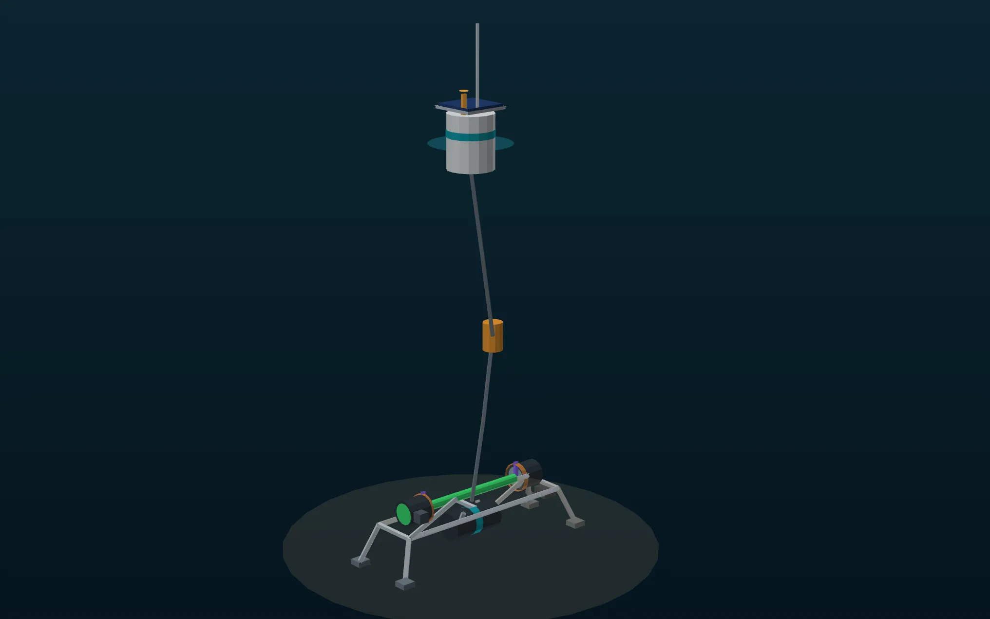
Design for the Submarius clarity sensor: a solar buoy tethered to a seabed frame holding the instrument

The design we are building toward. A solar buoy on the surface, the sensor on a seabed frame, and the beam crossing a fixed path of water between them.

On the bench

We are building the instrument.

A clarity forecast is only as good as the truth behind it, and almost nobody measures how far you can actually see underwater. We went looking, tested 17 live sensor networks, and not one of them sits within 2 km of a dive site. So we are building it ourselves. An LED, a photodiode, and a fixed path of water in between, measuring how much light survives the trip.

2.25 km
to the nearest live clarity sensor
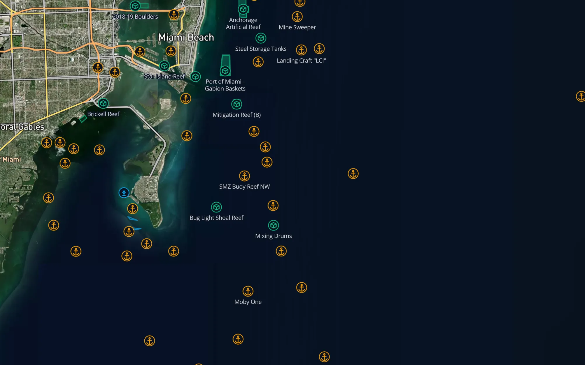
The Submarius reef and wreck map layer off Miami, showing named wrecks and artificial reefs

The structure layer off Miami. Named wrecks, artificial reefs and mitigation reefs, each carrying its own depth.

Shipping now

Every reef and wreck, worldwide.

Charts, state agencies and open map data all know where structure is, and they all disagree about it. Two of them put the same Keys wreck 4 km apart, and one of those sat 3.5 km from a completely different cutter. We pulled every catalogue we could reach into one place and worked out which records describe the same object, reading names and hull identity as well as distance, because distance alone gets it wrong. What comes out is one clean map, with the depth of the wreck itself and not just the sand beside it.

380,623
records in
289,927
structures out
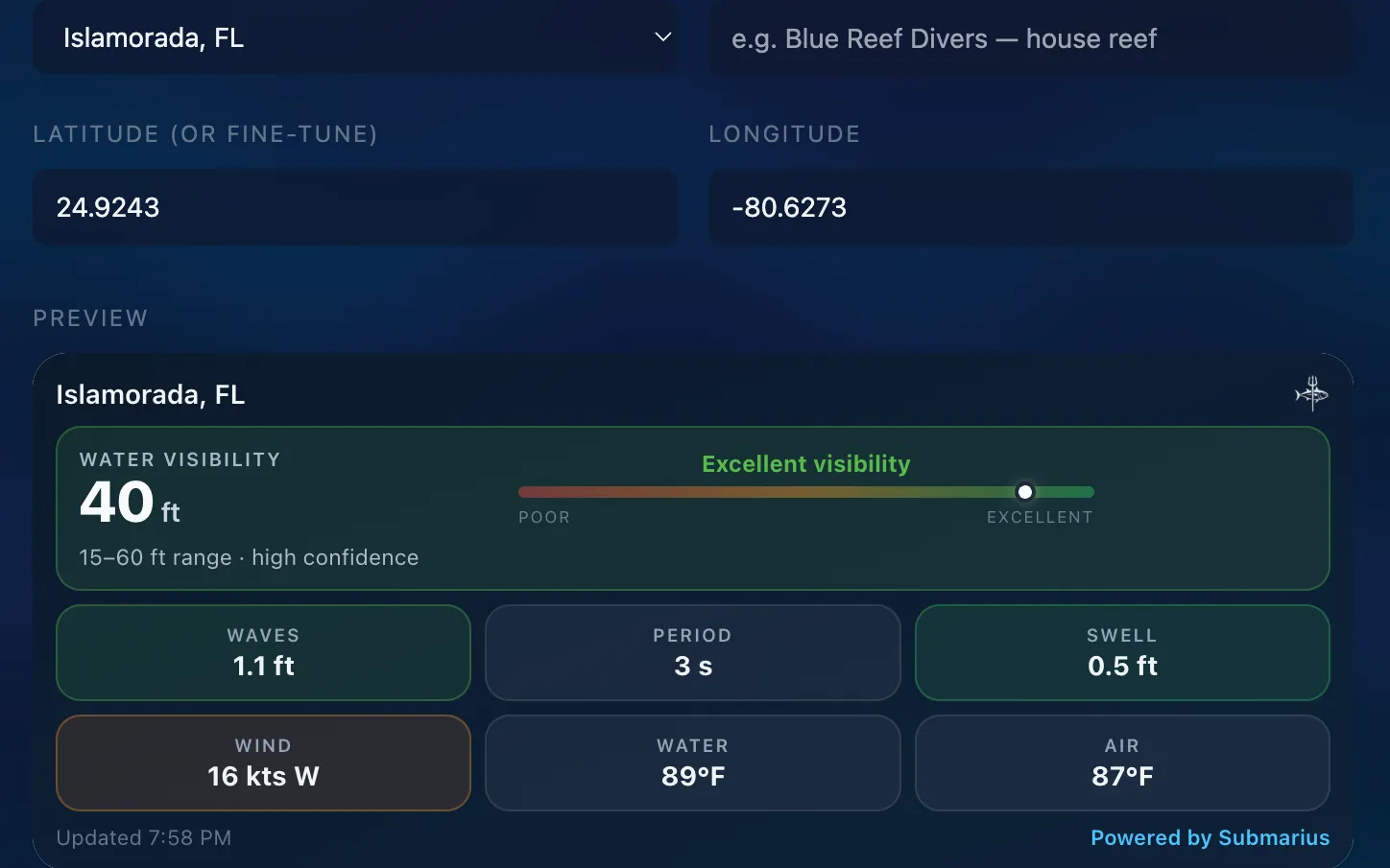
The Submarius widget builder showing a live conditions card for Islamorada, Florida

The widget builder. Pick the spot, name the card, paste one line of HTML into your site.

Partners on board

The people who put you in the water.

Dive shops and charters read their water better than any model does. They are the ones calling off a trip when the viz drops, and the first to know whether a forecast held up. The first shops are signed on. They get a free widget that puts live visibility for their own house reef on their own website, and what we build next comes straight from what they tell us they need.

Designed for every activity

Pick your mode. The dashboard reorders itself around the signals that matter for that activity. Multi-select supported. Switch anytime.

Spearfishing
Rod & reel
Scuba
Freediving
Boating
Sailing
Surfing
Kayak / SUP
In development

Help us build a water clarity buoy.

We are designing an affordable device that measures how far you can actually see underwater, for anywhere from open ocean to an inland spring. Before we build it, we want to hear what it would need to do for you, and what it should cost.

Free to start.

Current conditions, verdict, bite score, community spots, and every safety feature are free forever. Pro unlocks 8-day forecasts, unlimited spots, premium overlays, and offline maps.